Insurance Claims • Ponte Vedra Beach, FL
Ponte Vedra Beach Storm Erosion Assessment
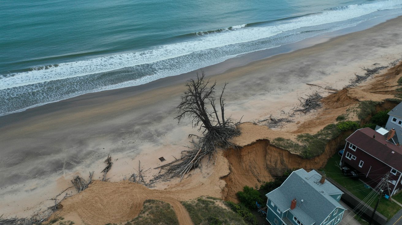
Project Summary
- Client: Coastal property owner / Insurance adjuster
- Location: Ponte Vedra Beach, FL
- Service: Post-Storm Beach Erosion Assessment
- Scope: 800 ft of coastline documentation
Results
- • Complete aerial survey of storm damage extent
- • Volumetric sand loss calculations (1,200 cubic yards)
- • Before/after comparison with archived imagery
- • Insurance claim: $145,000 approved for restoration
Deliverables
Aerial Survey
150+ high-resolution photos documenting erosion extent and damage
Orthomosaic Map
Georeferenced aerial map showing pre/post-storm coastline comparison
Volumetric Analysis
3D terrain modeling with sand loss calculations for restoration bid
Insurance Package
Formatted documentation with damage markers and cost estimates
Technical Notes
- Flight Plan: Automated grid mission (22 minutes, 150-300' AGL, 75% overlap)
- Camera: DJI Phantom 4 RTK (20MP RGB, PPK positioning for survey accuracy)
- Processing: Pix4Dmapper for orthomosaic and 3D terrain models, CloudCompare for volumetric analysis
- Baseline Data: Compared against pre-storm aerial imagery from county GIS database
- Turnaround: Field survey same-day, full analysis report within 48 hours